My Fascination for the NORTH:
It is basically due to my fascination for the North, that I am here at Kathmandu, with my family, for the last One year, away from the blistering & scorching Indian plains.
My Fascination for the North inspires me to move further North, North of Kathmandu, as and when time and resources permit. One such occasion, was when, we decided to venture to one of the northern-most tip of Nepal, called "Kodari", lying on the Nepal-China Border. So, for the second time, on 16th of May'2009, the D-Day came, as we (Mom, Dad, Sumona & Shristi included) started our audacious journey.
Our mode of conveyance.
The distance between Kathmandu to Kodari is a mere 120 kms, but it takes about 4 hours to travel the entire distance, one-way, on the "Arniko-Highway". About 30 kms from Kathmandu, lies the famous tourist-spot, called "Dhulikhel". It is here, that one can see the entire range of snow-capped Himalayas at a distance. Below is an artist's imagination of the beauty of Dhulikhel.
The Himalayan ranges from the twin crest of Mt. Langtang in the west to the Mt. Everest in the east can be clearly viewed in a clear day. Dhulikhel is ideal for snow-capped peaks, sunrise, sunset and it is different from any other place.
But, on 16.05.09, it being a cloudy day, no peaks were visible.
A view from Dhulikhel.
A view from Dhulikhel.
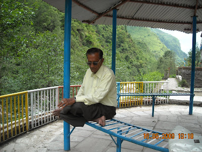
Dad at Dhulikhel.

Since, we had little to do at Dhulikhel, we decided to waste no time and moved on. Midway, a group of people, were seen canvassing for donation, for some reasons, best known to them. Having no choice, for obvious reasons, we donated a small amount, and moved on.
View of the group seeking donations.


The visuals offerred by Mother Nature on "Arniko-Highway", are, simply breathtaking and out of this world. One can see so many magnificent mountains, which are never ending. Between them lies the amazing "Sun Kosi" River. The scenery becomes increasingly dramatic as the gorge narrows and the road climbs.
The Sun-Kosi river
The creepy Road, called "Arniko-Highway", is a misnomer, as no sensible person in this world would call this "death-defying" road a Highway. This road follows the course of "Sun Kosi" river, through the Georges and valleys. For miles together, you may not find a single soul on this road.
The creepy Road alongside the serpentine River
"Sun Kosi" means river of Gold, perhaps named after the gold that is sometimes panned from the river gravels, or alternatively, it refers to the ornate color of the water in the monsoon, when it is thick with alluvial silt.

The Sun Kosi flows eastward in Nepal through the great valley between the Mahabharat Lekh mountains and the Himalaya. It forms the watershed for most of eastern Nepal, and gathering strength from tributaries draining the highest mountains in the world, it emerges onto the northern plains of India where it joins the Ganges.
Paddling the Sun Kosi is often described as one of the "ten best rafting trips in the world". Big rapids, warm water, no roads, continuous white water, beautiful scenery and great camping make this a classic eight day rafting trip. It is also an excellent river for kayaks.

A Tourist enjoying river-rafting on the Sun-Kosi River.
Paddling the Sun Kosi is often described as one of the "ten best rafting trips in the world". Big rapids, warm water, no roads, continuous white water, beautiful scenery and great camping make this a classic eight day rafting trip. It is also an excellent river for kayaks.

A Tourist enjoying river-rafting on the Sun-Kosi River.

In this 120 kms stretch of perilous road, lies many small villages, having shanties on the road-side, selling petty things.

You also find many small snack-bars, here called, "Khaja-ghar". They offer you fish-fries, "daal-bhat", and drinks of your choice.
The sight of the River from uphill, is simply superb, glorious and unparalleled.
To have a more awesome view, I got out of my Car. The untouchable beauty of the nature was at it's full bloom. With the occupants (Mom, Dad, Sumona & Shristi) remaining seated inside the Car, I took some of the incredible photos of the pristine Nature. Mother Nature was spotless and perfect.
My Car- very close to the sharp drop.

Though Superlative, the Nature can also be intimidating. At many places, one can see scary Land-Slides on the "Highway" itself. At times, the chicken-hearted fellows may reason the very purpose of their journey on this "Highway". There are sign-boards here & there on the road, screaming, "Beware- Rocks fall here from the hill ( read, hell )!"
A Land-slide on the road.

Land-slides apart, there are some stunning display of Natural waterfalls all along the road. And, they are many. Some are voluminous, some are small but elegant.
The Sun-Kosi River is always there to accompany you, if you are alone and unaccompanied.
As I said, the name "Highway" associated with this Road is a misnomer, as the following image of the Highway suggest.
Jokingly, The "Arniko-Highway", may be called a Highway, because it is built "High" on the mountains. The images below will suggest that this Road becomes a single-lane road on many sections and in some sections, the road altogether disappears.
As I said, the Road sometimes disappears altogether.
The large Container-Trucks, parked in a parking area, readying for the treacherous journey.
The bloodcurdling Road.

Sometimes, you will feel that you are all alone in this world, during your travel in this Road - It is only You and the Road and the River and the Mountains. With me, were of course, Mom-Dad-Sumona-Shristi; but, those Souls who travel all alone, may find the serenity, tranquility and the calmness of the Mother Nature very daunting.
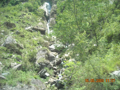
A Waterfall.
This one may be the Longest and the nearest Waterfall on this Road.
Mom & Dad in front of the Fall.
The foursome-Dad, Mom, Sumona & Shristi
Dad & Mom collecting Himalayan Peebles.

Another Landslide !
Houses dangling dangerously close to the edge of the Mountain.
Tragedies happen here, as a matter of routine. Unlike many tragedies, there is no alcohol or speeding or sheer reckless driving to blame, but only a minor miscalculation of the sort that countless competent drivers make everyday.
Locals call them Bloody Alley, the Road to Death, Massacre Mountain and Slaughter Lane. The images below will tell you why ?


Myself lost in thought in the "Bloody Alley".

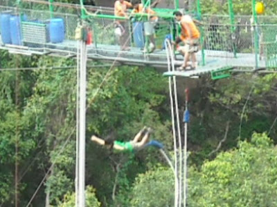
Close to the China Border, lies a hotel, named "Last-Resort", which mainly cater to the filthy-rich foreigners. They come here throughout the year to do "Bungy-Jumping".
"Bungy Nepal" at the "Last Resort" hotel may be the most spectacular jump on the planet. At 160 meters high in a tropical gorge with the "Bhote Kosi", one of the world's wildest rivers, raging below, Bungy Nepal is Nepal's Ultimate Rush and one of the longest free-falls in the world. The jump site was designed by one of New Zealand's leading Bungy consultants. Bungy Nepal takes place on a 166 meter wide steel suspension bridge.
Over 6000 meters of steel wire was used to build the bridge that joins two sides of a beautiful valley. Before the construction the local villagers had to walk five hours to cross the river gorge.
The Steel Suspension Bridge.
A Hoarding board of "Bungy Nepal".

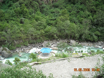
Just 5 kms short of Nepal-China Border, lies a famous tourist attraction, namely, "Tatopani", meaning, Hot-Water. Here, you find natural Hot-Water springs, having medicinal properties.

Tatopani means hot water, and since time immemorial, hot water gushing from the womb of the earth has fascinated humans all over the world. In Nepal, too, thermal springs have piqued the interest of yogis, philosophers, and medicine men and ordinary people. The soothing power of hot water on tired muscles, aching bones and tense minds have helped tatopanis to become pilgrimage spots where men and women ease physical disorders and gain divine blessings. The curative power of thermal springs has been known to the Nepalese since very ancient times. Bathing in these springs is especially recommended for those suffering from rheumatism, gout, and skin diseases.
Situated conveniently at an altitude of 1396 meters, the water of this spring is alkaline with slight sulphuric odur. Activites here take a festive turn in December when thousands of people from the surrounding villages, as well as from the kathmandu valley, throng here to take baths.
Mom, Sumona & Shristi at the Tatopani Hot-water Springs.
The "Bhote-Kosi" , tributary of the "Sun-Kosi", as they call it, flows right across the Tatopani.

I took this opportunity to bathe in the "Very hot" sulphur-y springs. Of course, there was no one to take the photos.
All five of us did a small picnic at the same spot. It was a memorable one, as we were really very hungry after a three and a half hours so-called "treacherous" journey. It was also memorable because you rarely get a chance to have home-cooked food, in the natural surroundings of Gigantic Himalayas & Ferocious River.
The four-some very near to China Border.
There was a sixth-one too !
The untamed River was at it's Natural Best.
Dad in an introspective mood at Tatopani.

The Four-some, giving a nice pose for us, at Tatopani.

I just wanted to tell her how much I love her. She's such a caring wife and a loving mother and I'm forever grateful that I'm with such an amazing person.
We used to dream of Angels, then she was given to us. And since then, She has touched our lives with Joy ! She will always be our sweet little Angel !
Kodari Elevation: 2250 meters; 7,382 feet.

Today's Journey to Nepal-China Border was just to make my Mom & Dad feel blissful and heavenly, in the lap of Nature.
Best part about my Mom & Dad has been that they never really taught us anything. They just lived their life and showed us the path of rightful living. They provided us with all the essentials of good life and never made us compromise on anything. Without ever showing how hard it could have been for them to provide such a decent life to all of us. Thanks to Mom & Dad for Everything. We really miss both, when they are at Bhopal, and us being at Nepal.
Mom and Dad at Tatopani.
Myself with my better-half, Sumona, below.
I just wanted to tell her how much I love her. She's such a caring wife and a loving mother and I'm forever grateful that I'm with such an amazing person.
My Sweet little Angel, Shristi, in a Meditative Mood, below.
We used to dream of Angels, then she was given to us. And since then, She has touched our lives with Joy ! She will always be our sweet little Angel !
Another Mother, the Mother "Nature".
The River in full glory.
Another engineering feat- Notice the house below and it's position on the Mountain, at the Nepal-China Border !

Finally, at 2.00 P.M, we reached "Kodari", the last point on this Highway, on this side of Nepal.

Finally, at 2.00 P.M, we reached "Kodari", the last point on this Highway, on this side of Nepal.
Kodari Elevation: 2250 meters; 7,382 feet.
Kodari is little more than a collection of shabby wooden shanties and a snaking line of squealing Tata trucks, ferrying Chinese goods down into the subcontinent.
It is possible to walk past the Nepali checkpoint and stop in the middle of the Friendship Bridge but you cannot pose for photos here. From here on is Tibet, which right here looks just like Nepal. The Chinese border post is 8km uphill at Khasa (Zhangmu). A Chinese visa and Tibetan travel permit is needed to progress further than this.
For a Nepali, special one-day permit is given to cross over up to Khasa, to buy cheap & fake Chinese goods. Photography is strictly prohibited here. All the photos taken and published below are taken very discreetly. At one point of time, I was caught taking photos, and the plain-clothed policeman asked me to hand-over the negatives. I somehow persued him that I deleted the photos I have taken from my digital Camera.
The Zhangmu town of China.
The freindship bridge and the Chinese Border.
The Border-post with Red flag.
Zhangmu Town lies in the southern piedmont of the median Himalayas, about 776 km away from the capital of Tibet Lhasa. After the drudgery of the Sino-Nepal Road, Zhangmu Town is a most welcome sight both for tourists and traders alike. Much is supposedly owed to nearby Mt. Everest, the highest peak in the world. Travelers come mainly for climbing up the lofty mountain, appreciating the heavenly sights, or pilgrimage at its holiness.
I can confidently say thet Capturing the images of China-Border Post and Zhangmu Town of China was a conquest and Coup over China.


2 comments:
You can also describe a journey step by step on MapVivo, eg. check out this amazing journey to Nepal: http://mapvivo.com/journey/8588#1.
The highway in city is from where? I see what looks like Chinese writing?
Post a Comment